pixijs
The HTML5 Creation Engine: Create beautiful digital content with the fastest, most flexible 2D WebGL renderer.
- 49k
- TypeScript
- MIT
- 1 d ago
High-performance visualization and interactive data exploration of scientific and geospatial location aware datasets
Repo OpenGeoscience/geojs, read from GitHub 1 min ago. OpenGeoscience has not joined Take My Repo.
OpenGeoscience/geojs is a public repo on GitHub by OpenGeoscience. High-performance visualization and interactive data exploration of scientific and geospatial location aware datasets. It declares the Apache-2.0 license on GitHub. It is written mainly in JavaScript, has 471 stars and last changed on 2026-11-20. Nobody has reviewed it on Take My Repo yet, which says nothing about its quality. Read from GitHub on 2026-11-21.
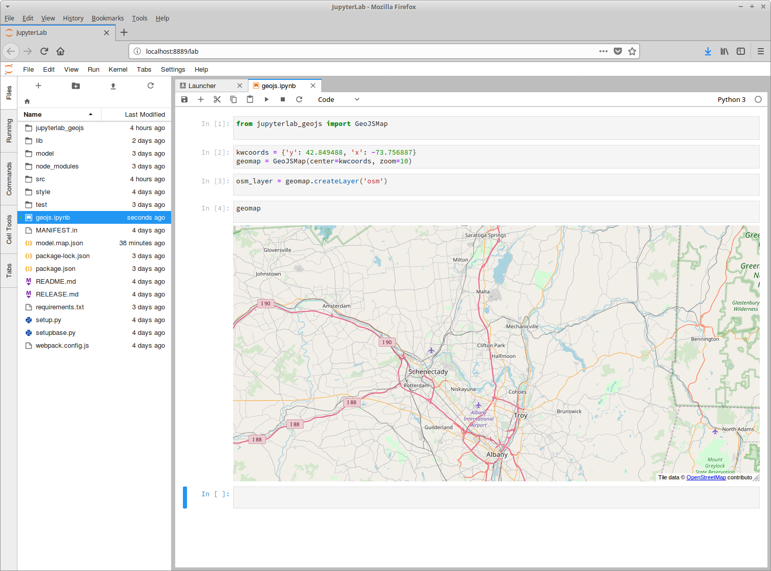
GeoJS is intended to bridge the gap between GIS, Scientific Visualization, and Infovis. GeoJS is more than just a GIS library as users can create scientific plots such as vector and contour and can embed infovis plots using D3.js. GeoJS aims for high-performance visualization and interactive data exploration of scientific and geospatial location aware datasets.
GeoJS supports features such as Point, Line, Polygon, and advanced features such as Pixelmap, Contour, Heatmap, and Choropleth.
GeoJS can read and render data from GeoJSON files, and WMS servers. Additional features includes Annotations, Legends, Animated Transitions, and Widgets.
GeoJS can also be used for visualizing medical imagery. See Digital Slide Archive for an example.
For live examples visit Github.io
You can find more information on GeoJS installation and usage in our Documentation.
There are some additional resources:
We would love to get your feedback and bug reports. Please use GitHub issues.
We are open for collaboration. Kitware has been doing open source development for the last 20 year and understands and appreciates what it takes to develop open source software.
GeoJS has been used in various Girder based applications such as Dansfield-App and DIVE.
OpenGeoscience/geojs is a public repo on GitHub by OpenGeoscience. High-performance visualization and interactive data exploration of scientific and geospatial location aware datasets.
It declares the Apache-2.0 license on GitHub.
Its maker has not tagged a system, so it is unknown here. Its README says what it needs.
Open "Take it" on its page: Take My Repo writes an install plan for your machine and hands it to your AI agent (Claude Code, Codex or Cursor), which asks you before each step. Take My Repo has not tested it on any machine.
Its last change on GitHub was on 2026-11-20. Take My Repo does not judge from that whether it is maintained.
Nobody has reviewed it on Take My Repo yet, which says nothing about its quality.
The HTML5 Creation Engine: Create beautiful digital content with the fastest, most flexible 2D WebGL renderer.
God's Eye View: a spy satellite simulator in your browser, except the data is real. Live open source spatial intelligence on a photorealistic 3D globe. Official site: godseyeview.ai
A curated list of awesome HTML5 Canvas with examples, related articles and posts.
An open-source JavaScript library for world-class 3D globes and maps :earth_americas:
Classes and scheduled tasks to automate the import of regularly updated online spatial data into GeoNode.