geoint

Open repos and models their makers tagged geoint, most starred first. The same for everyone.

AI agentsRepo

geo-sleuth

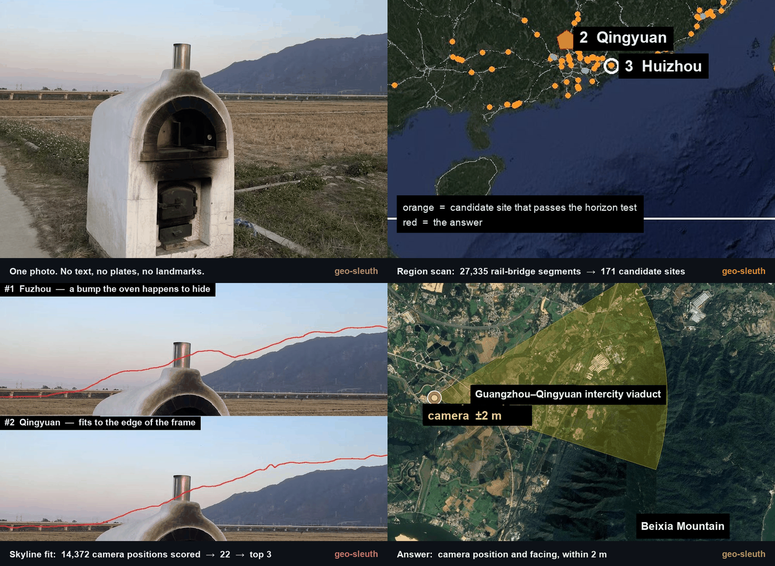
An agent skill that finds where a photo was taken — OpenStreetMap geometry, elevation skylines, satellite imagery and street view — and shows its work. Works with Claude Code, Codex, Cursor, Gemini CLI, OpenCode and GitHub Copilot.

  • 7.3k
  • Python
  • MIT
  • 11 h ago
OldcircleTake it
AI agentsRepo

satellite-mcp

Full-Spectrum Geospatial Intelligence MCP Server — 171 tools across 27 categories: satellite imagery, aircraft tracking, maritime intelligence, military & defense, space tracking, conflict mapping, environmental monitoring, and more

  • 10
  • TypeScript
  • MIT
  • 3 mo ago
badcharsTake it
Search GitHub and Hugging Face for geoint

Get , open it once and sign in. Then come back here and press the button again.

geoint: open source repos and models on Take My Repo