satellite-data

aitlas
AiTLAS implements state-of-the-art AI methods for exploratory and predictive analysis of satellite images.
- 232
- Python
- Apache-2.0
- 7 d ago


annotation
Annotation of datasets for deep learning applied to satellite and aerial imagery
- 64
- Apache-2.0
- 4 wk ago
unmixing
Interactive tools for spectral mixture analysis of multispectral raster data in Python
- 123
- Python
- MIT
- 7 y ago

2020a_SSH_mapping_NATL60
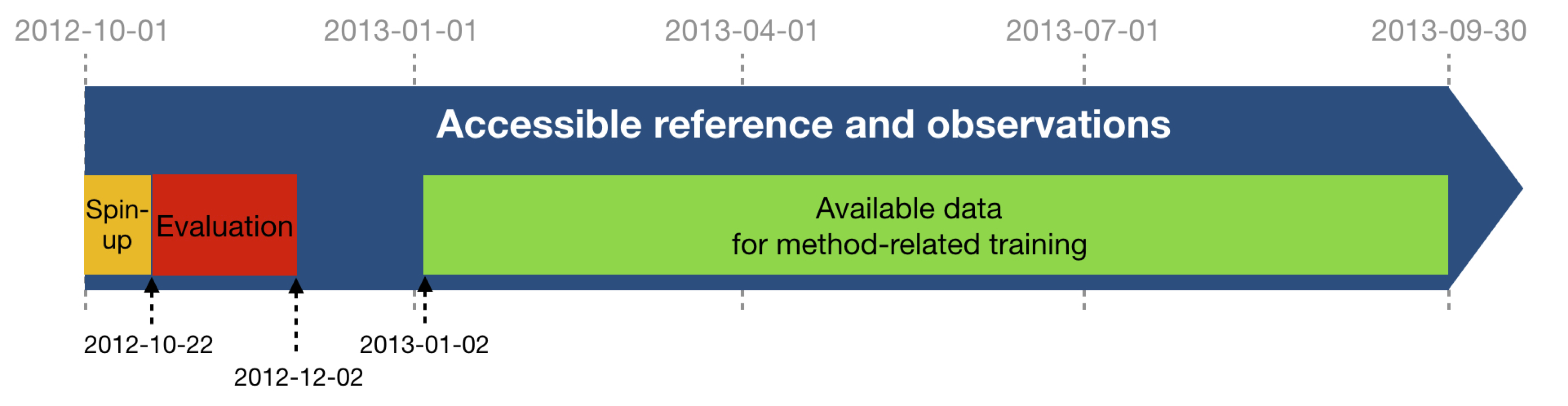
A challenge on the mapping of satellite altimeter sea surface height data organised by MEOM@IGE, Ocean-Next and CLS.
- 40
- Jupyter Notebook
- MIT
- 3 y ago


Floating-Marine-Debris-Data
Annotated Sentinel-2 imagery of floating marine debris (plastic, driftwood, seaweed, pumice, sea snot, sea foam)
- 37
- Python
- CC-BY-4.0
- 3 y ago


trusat-backend
- 33
- Python
- Apache-2.0
- 3 y ago

google-earth-engine-mcp
MCP server for Google Earth Engine. Query Google Earth Engine with natural language. Fetch datasets, run tasks and visualize in chat.
- 16
- TypeScript
- MIT
- 19 mo ago

Geoai Coding Agent
GeoAI Coding Agent - Geospatial AI Coding Assistant"
Runs in the browser on Hugging Face
- 2
- agpl-3.0
- 4 wk ago
Geospatial Ai Query
Query geospatial data with natural language interface
Runs in the browser on Hugging Face
- 1
- mit
- 4 wk ago
wildfire-alphaearth-sentinel
This MVP demonstrates a multi-indicator, high-reliability wildfire detection framework that surpasses conventional approaches. By combining Earth observation with intelligent vector analytics, it opens pathways to operational-scale environmental monitoring.
- 1
- Jupyter Notebook
- 16 mo ago

global-fire-monitoring-v3-2
Global Fire Monitoring System v3.2 is an advanced satellite-based fire analysis platform that leverages ESA CEDA Fire_cci data for large-scale global fire pattern detection and clustering analysis. The system processes 12,500+ grid cells simultaneously and provides comprehensive insights into fire behavior patterns across 6 continents.
- 0
- Jupyter Notebook
- MIT
- 14 mo ago
africa-fire-analysis-v1-4-4
Large-scale fire detection analysis using NASA FIRMS data feat: Add dynamic region support for Africa case study in v1.4.4 - Enabled flexible geospatial parameterization for wildfire analysis - Updated preprocessing pipeline to support Africa-specific satellite data formats.
- 0
- Python
- MIT
- 14 mo ago
north-america-fire-analysis-v1-4-3
Large-scale fire detection analysis using NASA FIRMS data feat: Add dynamic region support for North America case study in v1.4.3 - Enabled flexible geospatial parameterization for wildfire analysis - Updated preprocessing pipeline to support North America-specific satellite data formats.
- 0
- Python
- MIT
- 14 mo ago
eu-fire-analysis-v1-4-2
Large-scale fire detection analysis using NASA FIRMS data feat: Add dynamic region support for EU case study in v1.4.2 - Enabled flexible geospatial parameterization for wildfire analysis - Updated preprocessing pipeline to support EU-specific satellite data formats.
- 0
- Python
- MIT
- 14 mo ago
area-fire-analysis-v1-4
Large-scale fire detection analysis using NASA FIRMS data. feat: Add dynamic region support for South America case study in v1-4_area - Enabled flexible geospatial parameterization for wildfire analysis - Updated preprocessing pipeline to accommodate South American satellite data formats.
- 0
- Python
- MIT
- 14 mo ago
geospatial-and-earth-science-data
A comprehensive collection of global earth science and geospatial datasets 🌍
- 0
- GPL-3.0
- 23 mo ago


fire-monitoring-anomaly-reasoning-ceda-africa-v3-3
🔥 Advanced satellite-based fire anomaly detection & reasoning system for Africa using ESA Fire_cci v5.1 data with Isolation Forest ML and LLM-based explanations.
- 0
- Python
- 14 mo ago
fire-monitoring-anomaly-reasoning-ceda-asia-v3-4
🔥 Asia-Pacific Fire Anomaly Detection using ESA Fire_cci v5.1 & Isolation Forest ML.
- 0
- Python
- 14 mo ago