remote-sensing

sahi
Framework agnostic sliced/tiled inference + interactive ui + error analysis plots
- 5.6k
- Python
- MIT
- 3 wk ago

torchgeo
TorchGeo: datasets, samplers, transforms, and pre-trained models for geospatial data
- 4.2k
- Python
- MIT
- 3 d ago

geemap
A Python package for interactive geospatial analysis and visualization with Google Earth Engine.
- 4.1k
- Python
- MIT
- 5 d ago


awesome-remote-sensing-change-detection
A comprehensive and up-to-date compilation of datasets, tools, methods, review papers, and competitions for remote sensing change detection.
- 2.4k
- 2 mo ago


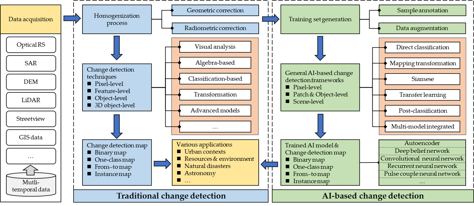
Change-Detection-Review
A review of change detection methods, including codes and open data sets for deep learning. From paper: change detection based on artificial intelligence: state-of-the-art and challenges.
- 913
- 5 y ago

python-geospatial
A collection of Python packages for geospatial analysis with binder-ready notebook examples
- 914
- Shell
- MIT
- 2 y ago
GeoChat
[CVPR 2024 🔥] GeoChat, the first grounded Large Vision Language Model for Remote Sensing
- 759
- Python
- 24 mo ago

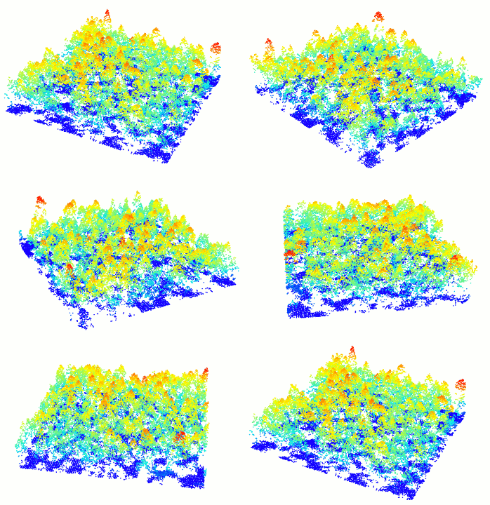

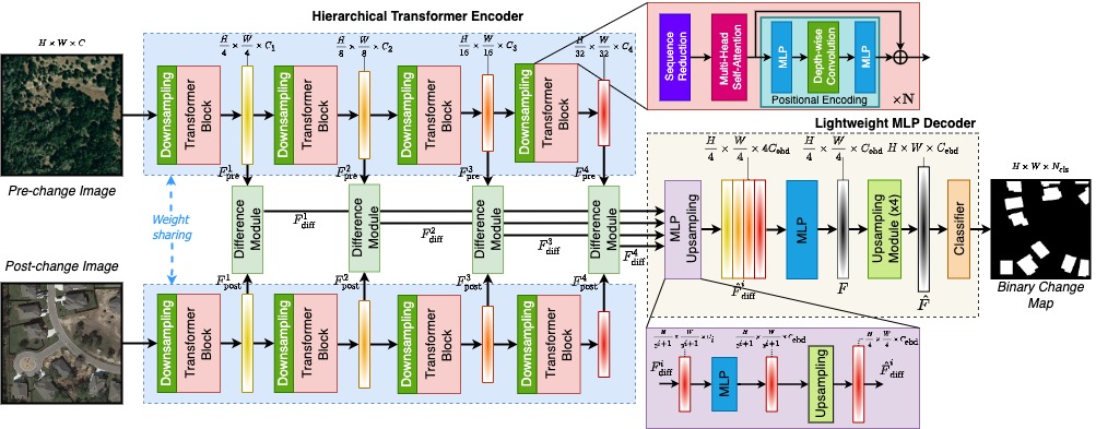
ChangeFormer
[IGARSS'22]: A Transformer-Based Siamese Network for Change Detection
- 630
- Python
- MIT
- 3 y ago


ChangeDetectionRepository
This repository contains some python code of some traditional change detection methods or provides their original websites, such as SFA, MAD, and some deep learning-based change detection methods, such as SiamCRNN, DSFA, and some FCN-based methods.
- 539
- Python
- MIT
- 5 y ago

ClimateVision
Open-source ML platform for detecting deforestation, ice melt, and flooding from Sentinel-2 / Landsat imagery.
- 378
- Python
- MIT
- 3 mo ago


xview-yolov3
YOLOv3 training, preprocessing, validation, and inference for object detection in xView satellite imagery and the xView detection challenge.
- 353
- Python
- AGPL-3.0
- 3 mo ago

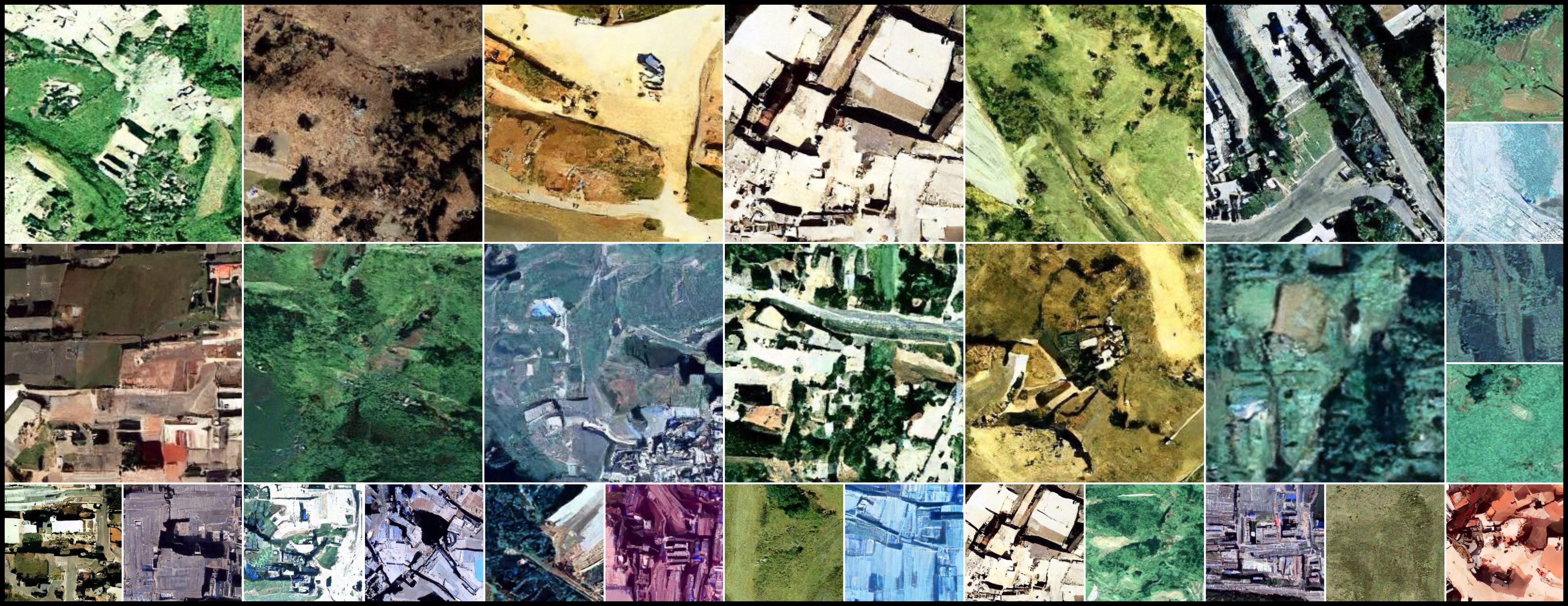
ddpm-cd
Remote Sensing Change Detection using Denoising Diffusion Probabilistic Models
- 351
- Python
- MIT
- 24 mo ago


geetools-code-editor
A set of tools to use in Google Earth Engine Code Editor (JavaScript)
- 325
- MIT
- 3 y ago

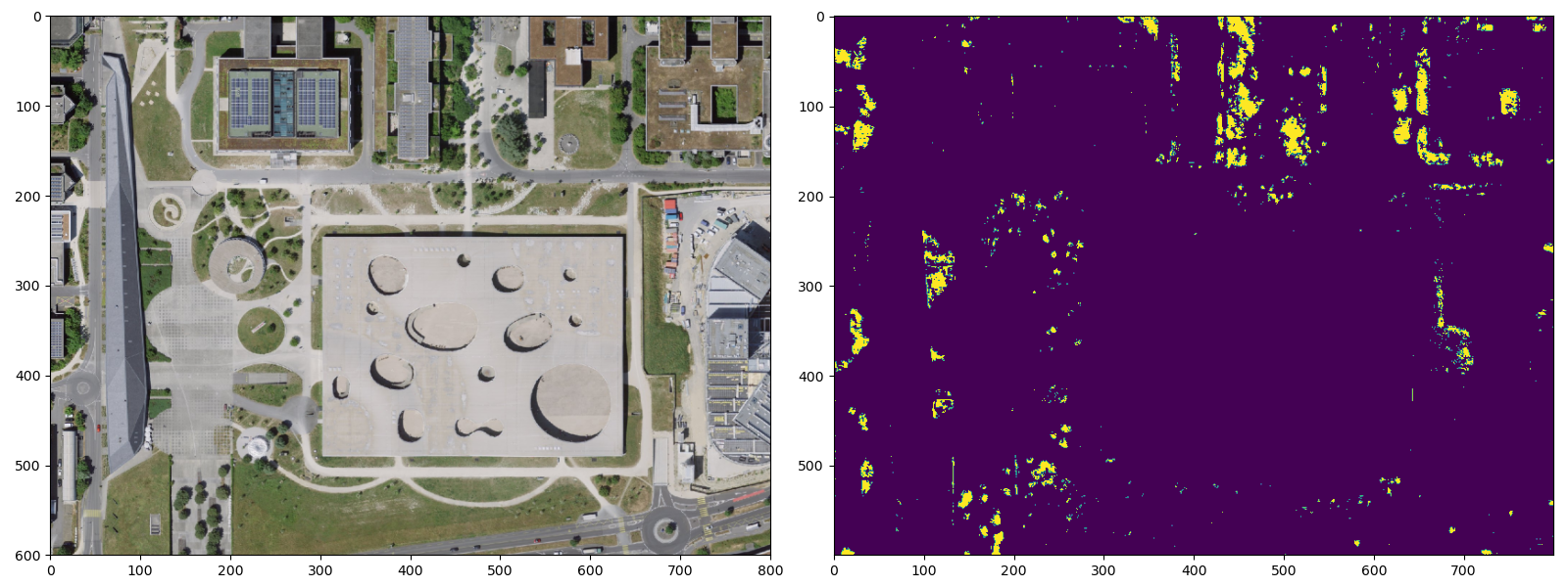

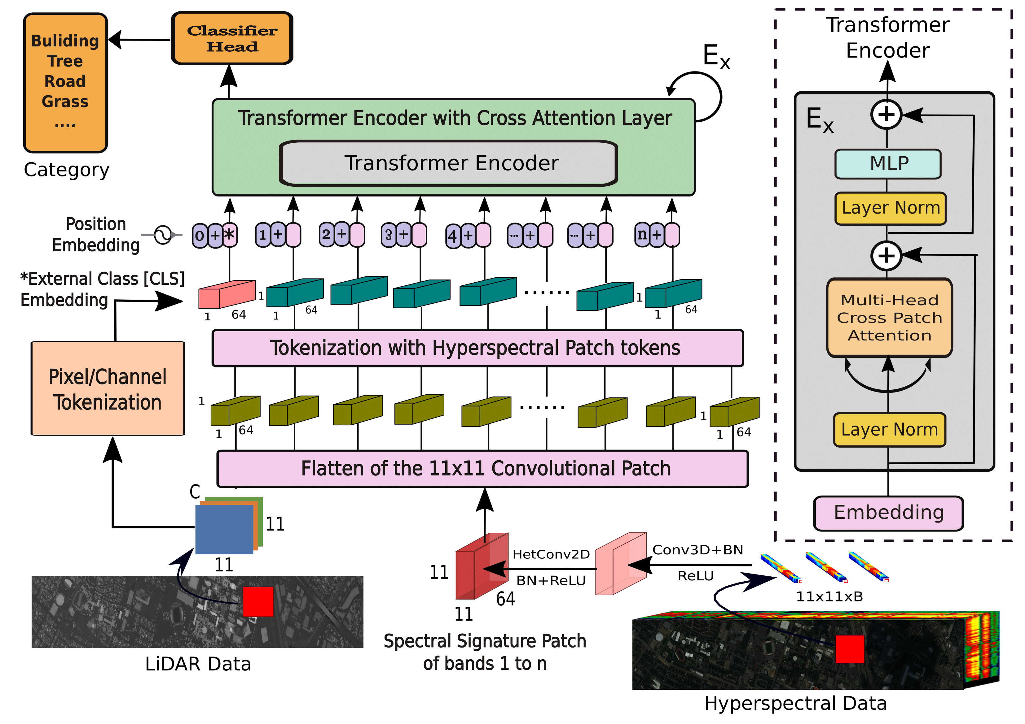
MFT
Pytorch implementation of Multimodal Fusion Transformer for Remote Sensing Image Classification.
- 246
- Jupyter Notebook
- 3 y ago

aitlas
AiTLAS implements state-of-the-art AI methods for exploratory and predictive analysis of satellite images.
- 232
- Python
- Apache-2.0
- 6 d ago


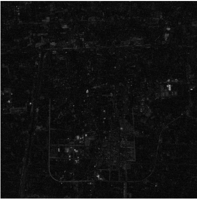



ai4rs
AI for remote sensing, remote sense, object detection, oriented object detection, computer vision, cv
- 166
- Python
- Apache-2.0
- 6 wk ago

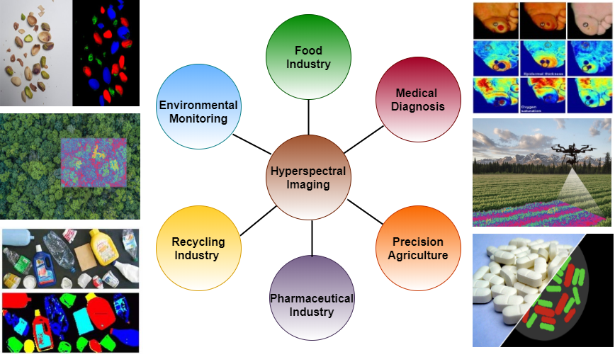
HSI-Traditional-to-Deep-Models
Pytorch and Keras Implementations of Hyperspectral Image Classification -- Traditional to Deep Models: A Survey for Future Prospects.
- 163
- Jupyter Notebook
- 4 y ago
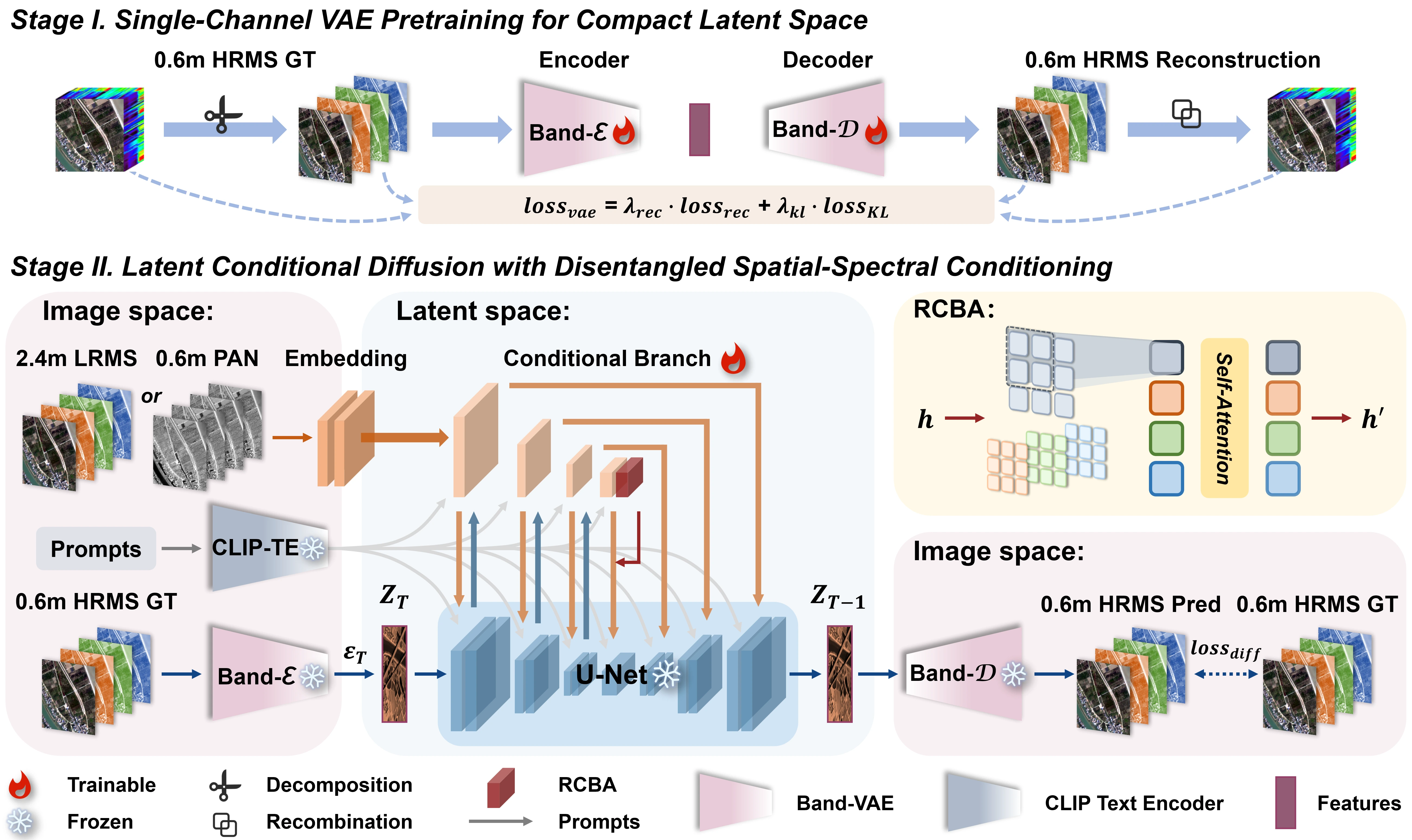
CC-Pan
🤗 [TMM 2026] Official implementation for "CC-Pan: Channel-wise Compression based Diffusion for Efficient Pan-Sharpening" https://arxiv.org/abs/2602.04473
- 156
- Python
- MIT
- 2 wk ago

awesome-object-detection-datasets
A collection of some awesome public object detection and recognition datasets.
- 146
- 23 mo ago

HSI_SSFTT
L. Sun, G. Zhao, Y. Zheng, and Z. Wu. "Spectral–Spatial Feature Tokenization Transformer for Hyperspectral Image Classification," in IEEE TGRS, 2022.
- 139
- Python
- 5 y ago

NASA-IBM-Lunar-Foundation-Model
Image feature extraction model, used with terratorch.
- 56
- 2.7k
- apache-2.0
- 3 mo ago
Crater-Detection-NASA-IBM-Lunar-Foundation-Model
Object detection model, used with terratorch.
- 1
- 875
- apache-2.0
- 2 mo ago
Ice-Prospectivity-NASA-IBM-Lunar-Foundation-Model
Image to image model, used with terratorch.
- 1
- 784
- apache-2.0
- 3 mo ago
IMP-Segmentation-NASA-IBM-Lunar-Foundation-Model
Image segmentation model, used with terratorch.
- 1
- 519
- apache-2.0
- 3 mo ago
geospatial-analytics-ai999x
Question answering model, used with geospatial-analytics-ai999x.
- 0
- 271
- apache-2.0
- 4 wk ago
binary-change-detection
- 0
- 33
- mit
- 6 mo ago